Most San Diego hikers know the big-name suffer-fests: El Cajon Mountain, Iron Mountain on a hot day, Cowles when it’s crowded. Far fewer know about Mount Gower, a quiet, grueling, wildly rewarding backcountry hike tucked into the hills outside Ramona. And that’s a shame, because this one has something the usual suspects don’t: a surprise.
For the first several miles, Mount Gower is a pretty standard (if relentless) chaparral grind. Then you climb up into a different world: smooth granite slabs the size of parking lots, boulders balanced like they were placed by a giant, hoodoo-style formations rising out of meadows, and a rock called Teepee Rock that looks exactly like what it sounds like. It feels less like Southern California and more like a chunk of the Sierra Nevada got dropped into East County.
It’s long. It’s steep. There’s almost no shade. Part of the route isn’t even a real trail. I used this trail for a Mt. Whitney training hike, And it’s absolutely one of the most interesting hikes in the county. Here’s what you need to know before you go.
Table of Contents
Trail Stats at a Glance
- Distance: ~9–10 miles out-and-back (GPS tracks range from about 8.2 to 10.6 miles depending on route and who’s counting)
- Elevation Gain: ~2,500 ft (tracked totals range from roughly 1,700 to 2,600 ft)
- Summit Elevation: ~3,100 ft
- Difficulty: Strenuous, with off-trail scrambling and route-finding near the top
- Time: 5–6.5 hours (faster hikers report closer to 4–4.5)
- Drive from Central San Diego: About 1 hour 15 minutes
- Shade: Almost none
- Hours: 8 AM to sunset daily (pedestrian access from sunrise); closed all of August for extreme heat
- Parking: Lot at the trailhead with restrooms, water, and a picnic area
- Best seasons: Fall through spring
Check before you drive out: Mount Gower is a San Diego County preserve, and the county can close it for heat, storm damage, or maintenance. Some trail listings show sections of the preserve marked as closed, so confirm current access with San Diego County Parks or call the park at (760) 788-3326 before you go. Dog rules have also been reported inconsistently, so verify those too if you’re bringing yours (and honestly, with this much exposure and scrambling, it’s a tough day for most dogs).
What Makes Mount Gower Different
Mount Gower Open Space Preserve covers about 1,574 acres of nearly pristine backcountry: dense chaparral, oak woodlands, streamside sycamores, and seldom-visited meadows. The preserve bounced back well after the 2003 Cedar Fire, and in spring the chaparral fills in with black sage, monkey flowers, and tall stalks of blooming yucca. Mule deer, coyotes, bobcats, and red-tailed hawks live here, and with luck you might spot a golden eagle.
The peaks themselves are a cluster of three summits sitting just beyond the preserve boundary on Cleveland National Forest land, and the preserve is the best way to reach them. The mountain is said to be named for John Gower, who is credited with discovering gold in nearby Julian. Before that, it was known as Black Horse Mountain.
But the real star is the rock. We’ll get to that in a minute.
Getting to the Trailhead
The trailhead is at the end of Gunn Stage Road in the San Diego Country Estates neighborhood, just outside Ramona. The address is 17090 Gunn Stage Road, Ramona, CA 92065.
Directions:
- Take Highway 78 east through Escondido and into Ramona
- At the junction with Highway 67, Highway 78 turns left. Instead, continue straight onto San Vicente Road
- Bear left where the road splits onto Wildcat Canyon Road
- Turn left onto Gunn Stage Road and follow it until it dead-ends at the parking area
Continue past the gate and the road leads to a good-sized parking area with restrooms, water, a picnic area, and an equestrian staging area. Fill your water bottles here. You won’t find another drop of reliable water on the mountain.
Trail Guide: Section by Section
Section 1: Trailhead to the First Junction (0–0.5 miles)
From the staging area, the trail starts climbing across a chaparral-covered slope on a wide, well-groomed path. About a quarter mile in, you’ll hit a fork. Go right toward the summit. The left branch leads to a viewpoint on the west end of the preserve, which is a nice short option if Gower is more than you want to bite off today.
Section 2: Climbing to the Ridge and the First Viewpoint (0.5–2 miles)
The trail keeps climbing with a steady uphill trend until it bears right onto a ridge, the western wall of Swartz Canyon. Before the trail drops into the canyon, look for a side trail leading to the first viewpoint. It’s a short, moderate scramble, and there’s a bench at the top.
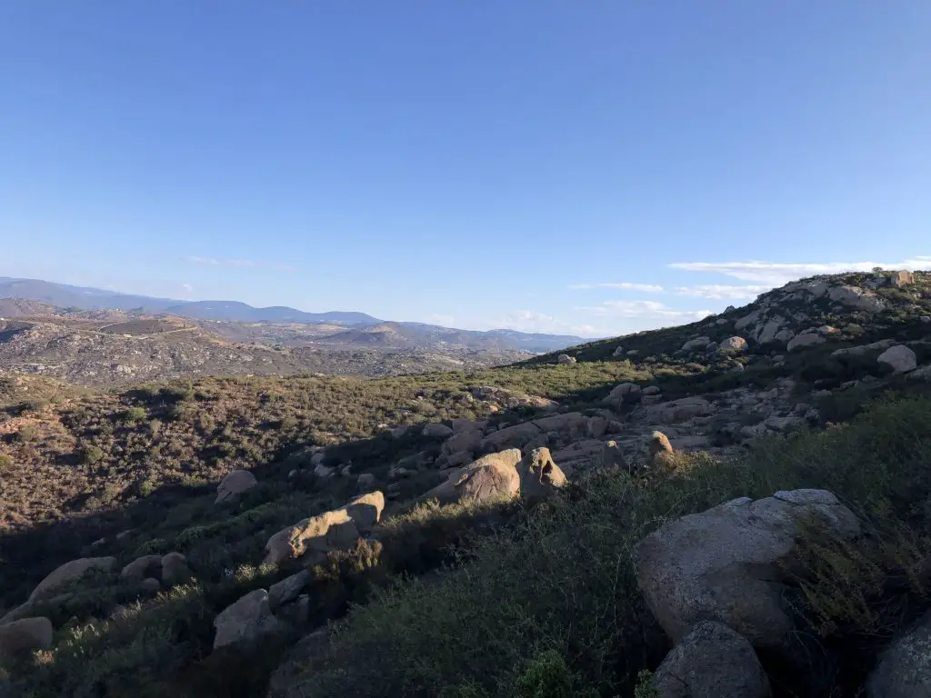
The view here is a taste of what’s to come: Ramona and San Diego Country Estates below you, Mount Woodson and Iron Mountain to the west, and rugged El Cajon Mountain in the distance. This is the smart turnaround point for anyone who wants a good view without committing to the full day. If you’re still feeling strong, backtrack to the main trail and keep going.
Section 3: Down and Up Swartz Canyon (~2–3.5 miles)
Here’s where the hike gets sneaky. After all that climbing, the trail drops down into Swartz Canyon. The bottom of the canyon is a surprise in the best way: an intermittent stream supports a shady riparian pocket of willows, live oaks, sycamores, and Engelmann oaks. It’s the only real shade on the entire hike, so enjoy it. Watch for poison oak in this area, and if it’s spring, look for wild cucumber and wildflowers.
This is the first place the hike gets hard. Out of the canyon, the trail climbs steeply up a set of switchbacks to the eastern rim. Remember the elevation you just lost? You’re about to earn it back. Tack on the fact that you’ll have to do this climb in reverse on the way home, and you can see why this section matters.
Section 4: The Ridge Walk (~3.5–5 miles)
Once you top out on the ridge, you’ll pass a water tower and continue climbing northeast toward the summit. For roughly the first 3.5 miles the trail is relatively smooth and easy to follow, but the character changes from here. The ridge undulates, with ups, downs, and a descent into another small canyon with a seasonal stream before a final short, steep climb.
This is the second place it gets hard, and it’s more mental than physical. The trail rolls along the exposed ridge with zero shade, and the ups and downs add significant elevation gain you won’t see on the profile at a glance. Reviewers consistently note that the ridge alone adds almost as much climbing as getting to it did. The views back toward the trailhead and Country Estates are nice, and the chaparral blooms well in spring, but this stretch is a grind. Pace yourself.
Near the end of this section you’ll pass a grassy meadow where the trail bends left, with a use trail leading toward some oaks. Don’t take it. Keep going, because the granite is just ahead.
Section 5: The Granite Zone and Summit Scramble (~5 miles)
This is it. The chaparral thins out, the boulders start showing up, and suddenly you’re in the part of the hike you came for. Smooth granite slabs, moss-covered outcrops, and jumbled boulder fields take over the mountainside. Seeing the slabs means you’re close to the summit, and it also means it’s time to leave the real trail.
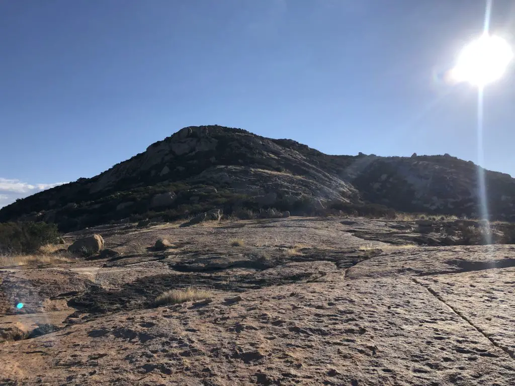
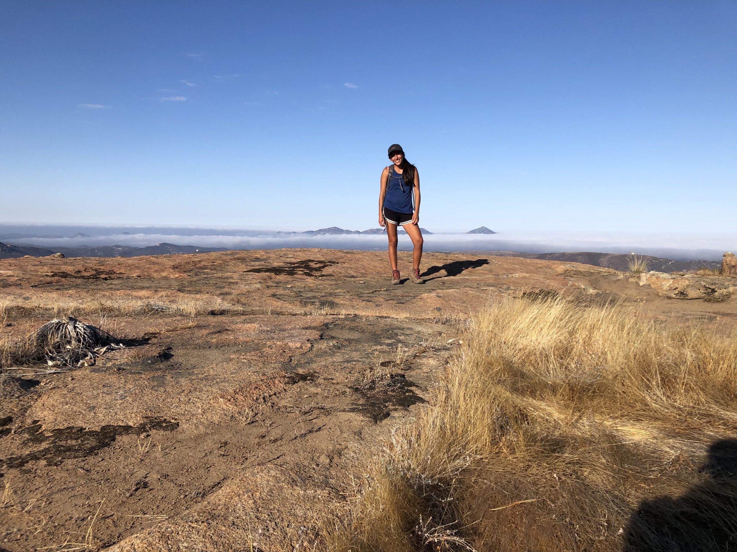
Look for a use trail climbing off to the left. Follow it up to the largest slab you’ll encounter, a huge flat expanse of granite with big views west and south toward the San Diego River Gorge. After a rainstorm, the depressions in this slab fill with water and create shallow pools.
From here, the use trail continues east over jumbled slabs filled in with moss, shrubs, and grasses. Sometimes you’ll see something that resembles a trail. Other times you’ll need to use your judgment or follow a GPS track. Expect real scrambling, steep boulder-strewn slopes, and plenty of hands-on-rock moments. Note that this stretch is where most of the route-finding trouble happens, and it’s the third place the hike gets hard.
Route-finding warning: The way up through the slab field is fairly obvious. The way back down is not. The use trail essentially vanishes across the granite, and it’s easy to miss the turn on the return, which can send you down side routes that add long, unnecessary detours. Download a GPS track before you go, look back frequently on the way up to memorize what the route looks like, and don’t rely on spotty cell service. If you aren’t comfortable off-trail, turn around at the slabs or at the first viewpoint. There’s no shame in it.
The Summit (~3,100 ft)
The summit is a rocky perch with sweeping views. On a clear day you can see Iron Mountain, Mount Woodson, Cuyamaca Peak, El Cajon Mountain, and the San Diego River Gorge, plus (on a great day) Black Mountain in Ramona, the Palomar range, and the Volcan Mountains. The Gower cluster is made of three separate summits, so don’t be surprised if you’re not entirely sure which one is the “official” high point. Enjoy the view, snap your photos, eat something, and save some energy for the descent.
The Rock Formations: Why Gower Is Worth the Effort
This is the part of the hike that sets Mount Gower apart from every other grind in the county. Like most of San Diego’s inland mountains, Gower is built from granite. The boulders formed deep underground millions of years ago, and as the land rose and the soil above eroded away, they were exposed. Years of weathering have rounded and sculpted them, but on Gower the sculpting got creative.
Teepee Rock. One of the park’s best-known landmarks, it’s formed by two separate boulders propped against each other like a tent frame. There’s a short view trail from here that adds about a half mile if you want to explore.
The Fangs. There’s one cluster of boulders that look unmistakably like a set of teeth jutting out of the hillside. You’ll know them when you see them.
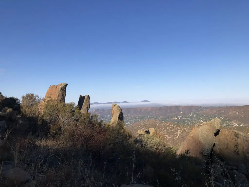
The Hoodoos. Three hoodoo-style rock formations dominate the landscape in the upper meadows, rising out of the grass like stone sentinels. This is the highlight for a lot of hikers, and it’s a great goal if the full summit isn’t in the cards. Some visitors turn around after the hoodoos and slabs and call it a day, which cuts the mileage down considerably.
The Giant Slabs. Near the summit, massive sheets of smooth granite recall the big sun-baked slabs you’d find in the Sierra Nevada. They’re draped in moss and lichen, with an impressive variety of both, and in the rainy season, the depressions fill up and turn into little pools. Walking across them is genuinely fun, just stay alert for slick patches when they’re wet.
It’s a landscape that feels totally out of place in San Diego County, which is exactly why it’s so memorable. Bring your camera.
Best Time to Hike Mount Gower
Fall through spring is the window. The county closes Mount Gower for the entire month of August because of extreme heat, and that tells you everything you need to know about summer. There’s essentially no shade on this hike, so a summer attempt is a bad idea even outside of August.
Winter gives you the best temperatures for a hike this long, and a post-storm visit means pools on the granite slabs. Spring brings wildflowers and blooming yucca across the chaparral, which makes the long ridge walk a lot more pleasant. Either way, start early so you have plenty of daylight for the descent and the route-finding on the way back. The preserve closes at sunset.
What to Bring
Water. At least 3 liters per person. There’s none on the trail, and you’ll be out there for most of the day.
A GPS track. Seriously. Download one to your phone before you leave (AllTrails or similar) and make sure it works offline. You’ll need it near the top.
Sun protection. Hat, sunscreen, and sun-protective clothing. Shade is basically non-existent.
Sturdy shoes with good grip. The granite scramble and the long downhill are hard on feet and knees. Trekking poles help a lot on the descent, which hikers regularly describe as brutal on the knees and toes.
Snacks and electrolytes. This is a 5-plus hour effort. Eat along the way.
Long pants or a poison oak plan. There’s poison oak down in Swartz Canyon. Look, don’t touch.
The Bottom Line
Mount Gower is not an easy day. It’s long, steep, exposed, and the last stretch requires real route-finding. But it’s also one of the most unusual and rewarding hikes in San Diego County, a place where the scenery shifts from chaparral to a granite wonderland you’d swear belongs two hundred miles north. Go in the cooler months, start early, bring more water than you think you need, and download that GPS track.
And if the full summit feels like too much, there’s a great hike hiding inside this one: go to the first viewpoint, or push to the hoodoos and slabs, and head back. Either way, you’ll see why the people who’ve done this hike tend to talk about it for a long time.