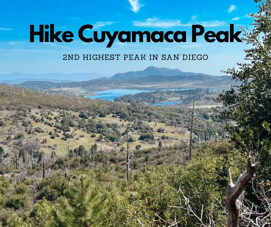
Cuyamaca Rancho State Park is a beautiful park located 50 miles east of San Diego. It’s only 20 min south of Julian. There are over 100 miles of trails for hiking, biking, and equestrian use. The popular trails in the area include Cuyamaca Peak and Stonewall Peak. This post will give you all the information needed to hike Cuyamaca Peak Loop Trail, including the alternate dog friendly route.
In addition to hiking trails there are also two options for camping in Cuyamaca Rancho State Park: Paso Picacho Campground and Green Valley Falls. Keep reading to find out more.
Table of Contents
Quick Facts: Cuyamaca Peak Loop Trail
These are the hiking details for Cuyamaca Peak Loop Trail via Azalea Glen Loop
- Cuyamaca Peak Trailhead: Google Maps Link
- 7.7 mile loop
- 1,833 ft elevation gain
- Max elevation: 6,512 ft
- Moderate to challenging hike
- Not dog friendly
- Parking/ day use fee $10 (accepts credit cards/ exact cash only)
- AllTrails Link
There is an alternate route if you’d like to bring your dog or are looking for a shorter route (5.5 miles). In general, Cuyamaca Rancho State Park is not very dog friendly. Dogs are allowed only in campgrounds, picnic areas, paved roads/ Cuyamaca Peak Fire Road. The only dog friendly hiking trail in Cuyamaca Rancho State Park is Cuyamaca Peak via Lookout Road (read below).
Related: Hiking Stonewall Peak at Cuyamaca Rancho State Park
Cuyamaca Peak Trailhead
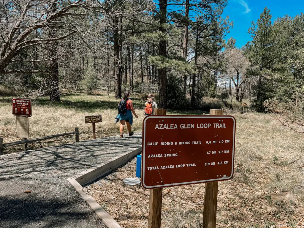
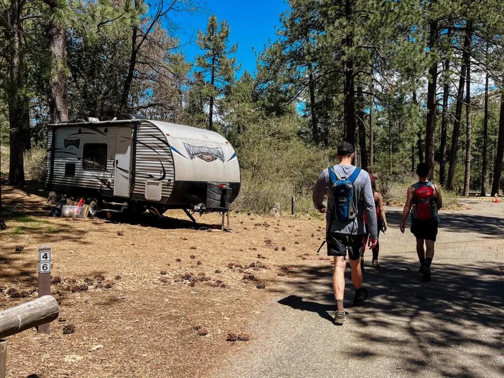
Cuyamaca Peak Trailhead is located inside Paso Picacho Campground. Parking is available in the day use area. There are also bathrooms, water, and picnic tables available near Cuyamaca Peak Trailhead.
Cuyamaca Peak Loop Trail starts on the Azalea Glen Loop and finishes descending the paved fire road. The trailhead is different if you’re taking the dog friendly route.
What To Expect Hiking Cuyamaca Peak Loop Trail
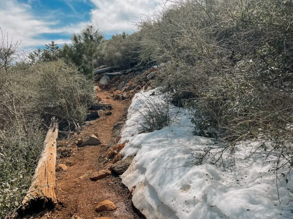
After starting out on Azalea Glen Loop, you’ll begin hiking next to a seasonal creek. In mid April of 2023, after a record rain year, the creek was full with water and there were several creek crossings about ankle high. The small creek crossings are easy to navigate with the abundance of rocks around to help you hike across. I imagine during a normal spring season, when San Diego doesn’t get as much rain, these creek crossings are non-existent.
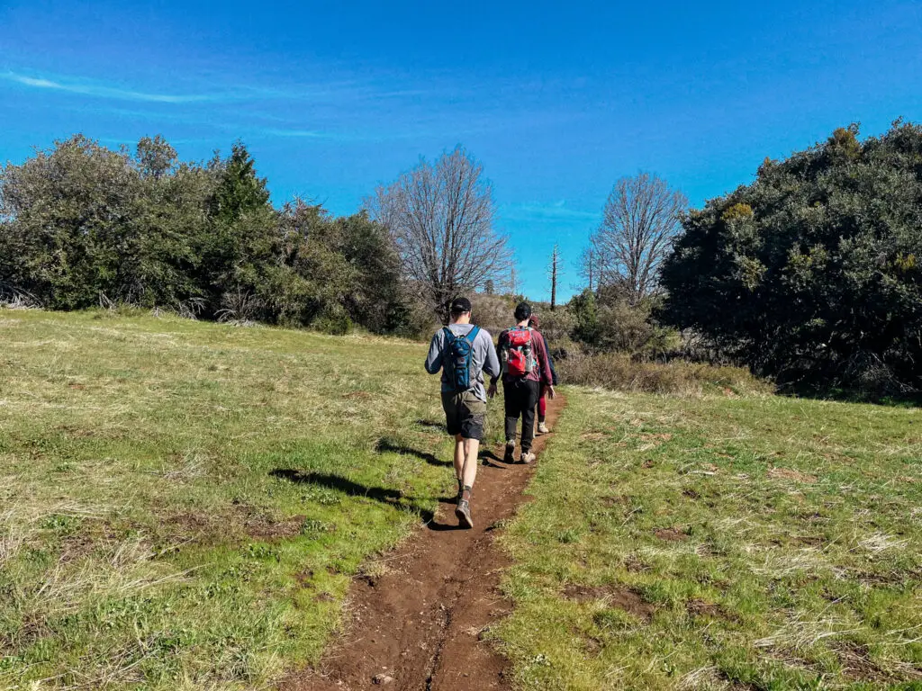
The start of the hike is relatively flat and shady. There are several junctions in the trail. It’s best to have the Cuyamaca Peak Loop Trail downloaded on AllTrails. About 2.5 miles into the hike, you’ll come to a T junction with Conejos Trail on your left. You’ll hike up Conejos Trail for the next 2 miles. There is a trail marker to help you spot the turn.
Conejos Trail was personally my favorite part of the hike. The switchbacks make the incline doable, and the views continuously get better the higher up you get. Most of the hiking trail is exposed but there is a small section on Conejos Trail that is covered with pine trees, providing some shade and making it smell like Christmas. We also spotted some snow leftover from the winter!
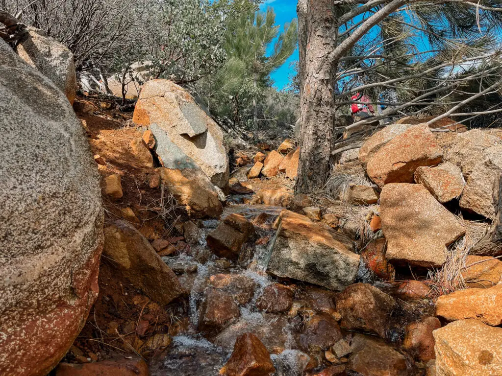
On Conejos Trail is where we came across the most water. At the time of my hike (mid April 2023) the snow melt from the summit was still working its way down along the trail. It was easy to navigate. Trekking poles would help stabilize your footing.
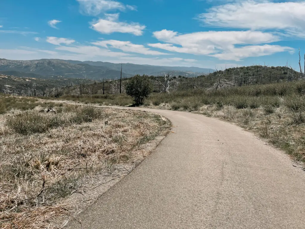
After 2 miles, the Conejo Trail meets with Lookout Road. Take a right onto the paved fire road which will lead you to the summit. It’s a steep incline but worth the views!
Is Cuyamaca Peak hard?
Cuyamaca Peak is considered a moderate to challenging hike. Combine the elevation gain with the lack of shade and high temperatures during summer and you have yourself a tough hike!
Cuyamaca Peak is the second highest mountain in the San Diego area. It’s not to be taken lightly and is not recommended for beginners. If you come prepared with plenty of water, a hat, sunscreen, and take breaks as needed then Cuyamaca Peak is an enjoyable challenge with rewarding views at the summit.
Summiting Cuyamaca Peak Loop Trail
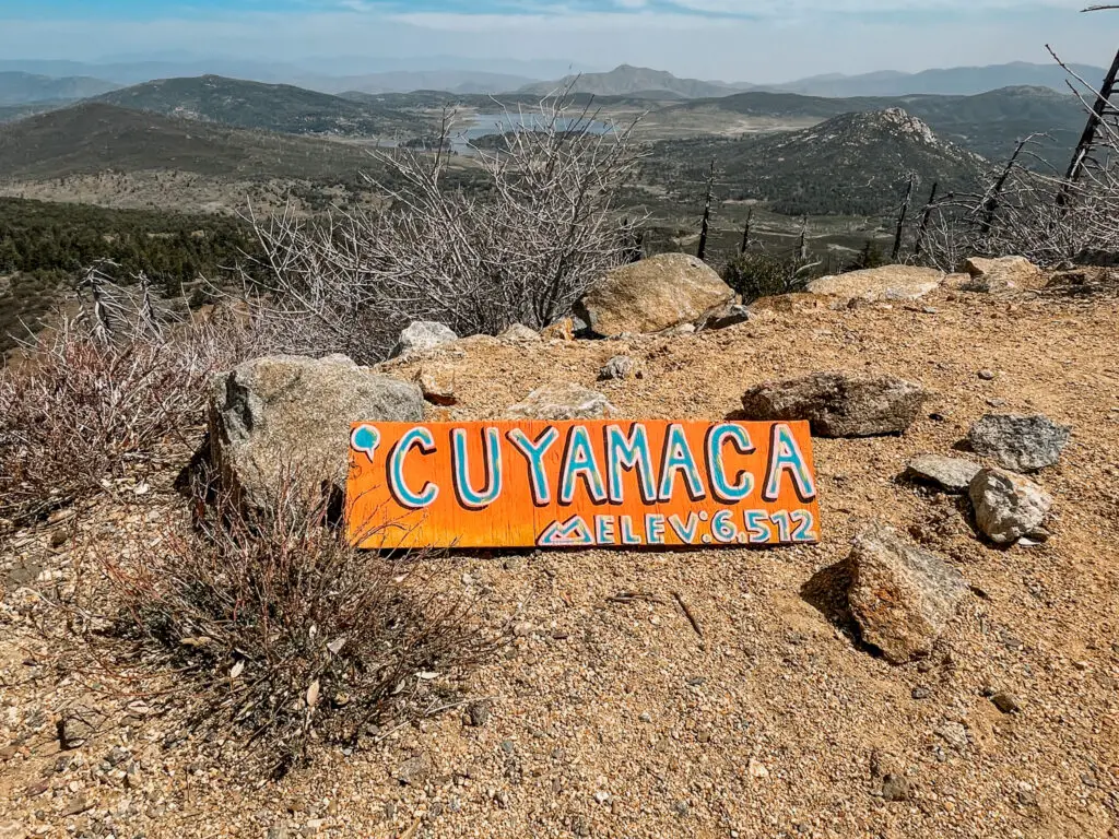
Cuyamaca Peak is the second highest peak in San Diego. Hot Springs Mountain being the tallest but more difficult to get to. Cuyamaca Peak sits at 6,512 ft and is only 20 feet lower than Hot Springs Mountain.
Cuyamaca Peak offers amazing, panoramic views of the surrounding area. I highly recommend you come on a clear fall day. The views are best after a good rain has cleared out the marine layer that typically lingers over the San Diego coast.
Best Time to Hike Cuyamaca Peak Loop Trail
Cuyamaca Rancho State Park can get really hot during late spring/ summer. Since the hiking trail is mostly exposed it’s best to come when temperatures are cooler.
The best time to hike Cuyamaca Peak Loop Trail is during early spring, fall, or winter. Although the hike is open during summer, temperatures can quickly rise and can result in heat exhaustion if you’re unprepared. Always check the weather before hiking Cuyamaca Peak Loop Trail and pack a hat and sunscreen.
Keep in mind during winter, Cuyamaca Peak is known for getting several inches of snow that can accumulate to multiple feet! The winter turns Cuyamaca Peak into a winter wonderland but should only be attempted by experienced hikers with the appropriate gear.
With snow also comes chain restrictions. If it’s that time of year, be sure to check for road closures and current chain requirements before driving up the mountain.
Alternate Route: Cuyamaca Peak via Lookout Road
If you plan on bringing your dog to Cuyamaca Rancho State Park, this is the only dog friendly trail in the entire park. Dogs are allowed on paved roads. For dog owners, hiking Cuyamaca Peak via Lookout Road is a saving grace.
- 5.5 miles out and back via paved road
- 1,640 ft elevation gain
- AllTrails Link
- Dog friendly (must be on leash)
- Parking/ day use fee $10
Unlike Cuyamaca Peak Loop Trail, Cuyamaca Peak via Lookout Road is an out and back hike. Parking is the same for both routes. The trailhead is different. The trailhead via Lookout Road is located inside the campground.
Lookout Road is a paved fire road that starts at Paso Picacho Campground and leads all the way to Cuyamaca Peak. It’s a straightforward hike. Keep in mind that the paved road gets hot and can easily be too hot for your dog’s paws during the summer.
General rule of thumb: If you cannot keep the back of your hand pressed to the pavement for 7 seconds, then the pavement is too hot for your dog’s paws (AKA the second-second test).
Camping In Cuyamaca Rancho State Park
There are two different options for camping in Cuyamaca Rancho State Park: Paso Picacho Campground and Green Valley Falls Campground.
Quick facts: Camping in Cuyamaca Rancho State Park
- Standard sites are $40 per night
- 8 people max per site
- 1 vehicle included in reservation
- Additional vehicles are $10 per night
- Dogs are allowed in the campground and paved roads only (must be on a leash)
- Check in: 2pm
- Check out: 12 pm (noon)
- Campgrounds are only open spring- fall
Both campgrounds have around 80 campsites and can accommodate tents/ trailers up to 30 ft. There are no hookups for trailers but there is a dump station at both campgrounds. Green Valley Falls has swimming holes and small seasonal waterfalls that are perfect on a warmer day.
Paso Picacho is located right next to the most popular hikes in the park: Cuyamaca Peak and Stonewall Peak. It’s also only 2 miles away from Lake Cuyamaca which offers boating and fishing. There are also a handful of cabins available to rent at Paso Picacho.
Keep in mind that these campgrounds closed during the winter months due to snow. They are available to book spring through fall on ReserveCalifornia.
Hiking Newsletter
Sign up for my hiking newsletter below. I’ll send you info on hiking trails, new blog posts, and any group hikes that I host.